KACSAT Engine and Biomass Estimations
GMT is committed to preserving and restoring the mangrove forests in the 001-OxC project area. To achieve this, GMT relies on the guidance from KACSAT, a powerful tool designed to monitor changes in deforestation rates, carbon sequestration, and mangrove forest coverage. The KACSAT system plays a critical role in determining the baseline data necessary to effectively manage the project area.
Assessing Historical Deforestation with KACSAT
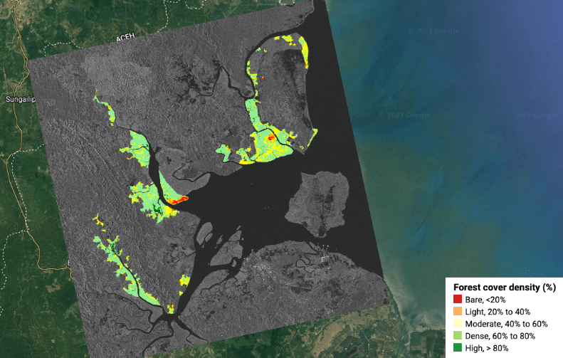
One of the key functions of the KACSAT system is to evaluate historical deforestation rates in the project area. This data is crucial in determining future rates of unplanned deforestation and in creating a designated leakage belt. The system is equipped with the capability to perform high-resolution forest density analysis, which allows GMT to gain a deep understanding of the distribution of forest density within the project area.
KACSAT classifies the forest cover percentages into five categories: bare, light, moderate, dense, and high. These classes are further divided based on their location relative to either water or roads as lower and higher than 10 meters. This information is used to guide GMT’s forest inventory and soil sample work in the field.
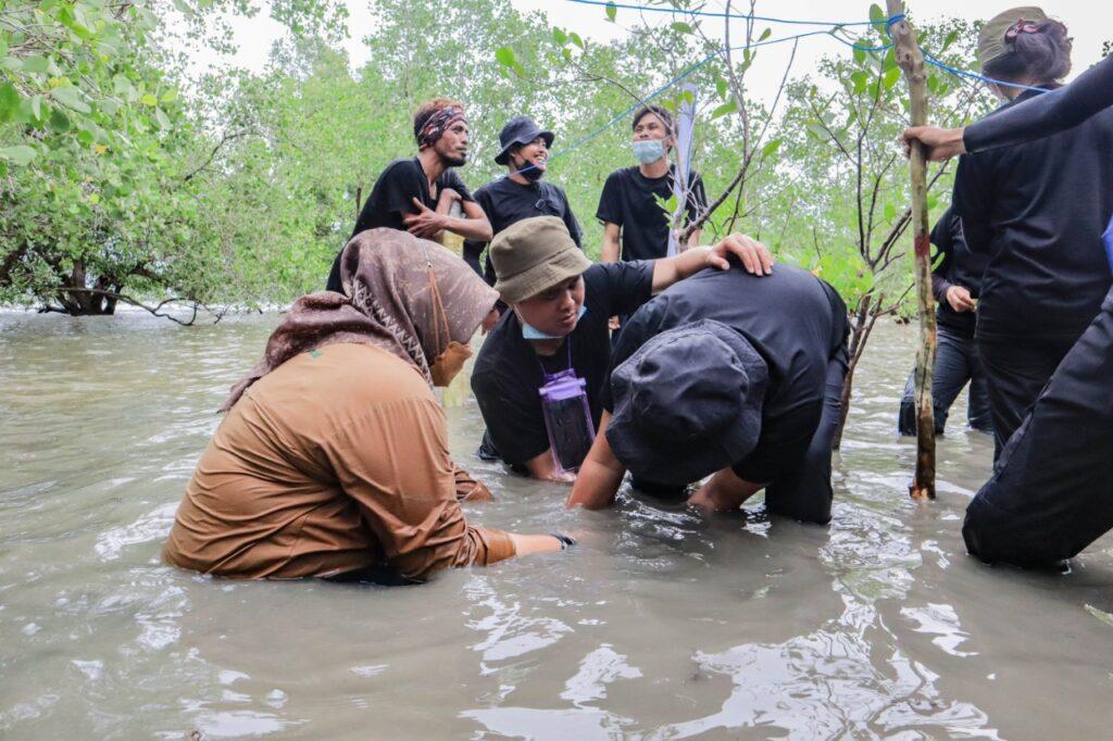
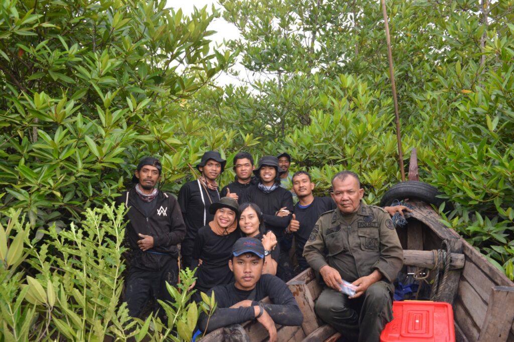
In-Situ Measurements in the Field
GMT conducts in-situ measurements in the field with the help of seven trained forestry teams. Each team is responsible for collecting soil samples and tree data, as well as measuring key parameters such as diameter at breast height (DBH), tree height, and other relevant field measurements.
Mangrove species found in the 001-OxC region offer ecological solutions for reducing coastal erosion and managing seasonal floods and sudden high ocean waves. These forests also provide habitats for a diverse range of coastal and marine organisms, including birds, tropical fauna, and fish. The most dominant species in the project area is Rhizophora apiculata, accounting for 49% of the mangrove forest cover, followed by Bruguiera sexangula (11.2%) and Lumnitzera racemose (10.3%).
Comprehensive Analysis of Soil Components
In addition to collecting tree data, GMT also takes in-situ measurements for soil and water parameters, such as soil pH, temperature, conductivity, and moisture, as well as water pH/temperature, total dissolved solids/electrical conductivity (TDS/EC), and salinity. The laboratory measurements encompass a comprehensive analysis of various soil components, including soil Carbon stock, water content, soil fractionation (sand, silt, and clay), and Nitrogen content. KACSAT uses this data to produce high-resolution Above-ground Biomass (AGB) and Below-ground Biomass (BGB) calculations, and deforestation rates
Biomass Estimation with KACSAT Engine
The KACSAT engine is designed to generate high-quality land use classification satellite images for a thorough analysis of deforestation and the development of biomass estimates for the project. The engine operates two core applications. The first is the generation and utilization of land cover classification and forest density analysis, while the second involves the development, calibration, and deployment of a carbon estimation engine to assess the carbon stocks of dynamic mangrove forests, both above and below ground.